
LiDAR vs Photogrammetry: 3D Construction Site Scanning Technology Comparison
Huzefa Motiwala October 22, 2025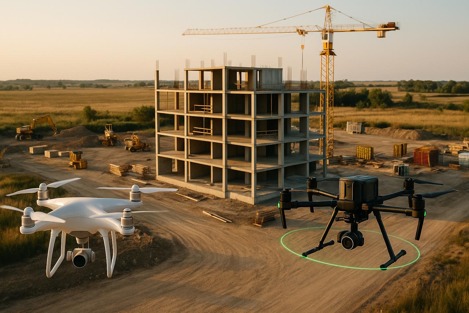
In construction, choosing the right 3D scanning technology – LiDAR or photogrammetry – can make or break your project’s success. Here’s the key takeaway:
- LiDAR is laser-based, delivering precise geometric data with millimeter-level accuracy. It’s ideal for projects needing high precision, works in any lighting, and handles complex environments. However, it’s expensive and requires specialized training.
- Photogrammetry uses overlapping photos to generate photorealistic 3D models. It’s more affordable, easier to use, and great for visual details but less accurate under poor lighting or in featureless areas.
Quick Comparison
| Factor | LiDAR | Photogrammetry |
|---|---|---|
| Accuracy | 1-5 mm | 5-15 mm |
| Cost | $80,000–$350,000 (hardware) | $2,000–$30,000 (hardware) |
| Lighting Needs | Works in any lighting | Needs good lighting |
| Output | Geometric precision | Photorealistic visuals |
| Ease of Use | Requires training | Beginner-friendly |
| Best For | Indoor scans, structural monitoring | Visual presentations, large open areas |
For tight budgets or visually-driven tasks, photogrammetry is a solid choice. For precision and challenging conditions, LiDAR leads. Many projects benefit from combining both for maximum results.
Photogrammetry + Lidar Accuracy Field Test: How Accurate is Propeller PPK?
Technical Differences and Core Capabilities
LiDAR and photogrammetry stand apart in how they capture and process spatial data. Grasping these differences can help you decide which technology best suits your construction scanning needs.
Data Collection and Accuracy Levels
LiDAR works by actively emitting laser pulses to measure distances. This direct measurement method delivers impressive accuracy, typically ranging from 1-5 mm in terrestrial scanning. The result is a highly detailed geometric map.
Photogrammetry, on the other hand, relies on natural light and overlapping images. By capturing multiple photographs and using algorithms to triangulate 3D coordinates from 2D images, it creates a model. However, its accuracy depends on several factors like camera quality, image overlap, lighting, and the distance from the subject. Under ideal conditions, photogrammetry achieves 5-15 mm accuracy, but inconsistent lighting or camera shake can significantly reduce precision.
The density of data points also varies between the two. LiDAR produces uniform point clouds with consistent spacing, capturing over 1 million points per second with modern scanners. This ensures even coverage across the scanned area.
In contrast, photogrammetry generates variable point clouds. Areas with rich textures or distinct features result in dense data, while uniform surfaces like plain concrete walls may have sparse coverage. This variability can lead to gaps in the 3D model, especially in environments lacking visual detail.
These differences in measurement methods directly influence the quality and usability of the final outputs.
Output Quality and Lighting Requirements
The outputs of LiDAR and photogrammetry reflect their unique data collection approaches. LiDAR excels at capturing precise geometric data, producing monochromatic point clouds that focus solely on spatial coordinates. This makes it ideal for measuring distances, volumes, and structural details.
One of LiDAR’s key advantages is its independence from lighting conditions. Whether in bright sunlight, overcast weather, or complete darkness, LiDAR consistently delivers high-quality data. This flexibility allows scanning to proceed regardless of weather or time of day.
Photogrammetry, however, creates photorealistic 3D models that include colors, textures, and visual details of the site. These models are excellent for identifying materials, spotting defects, or communicating progress to non-technical stakeholders.
That said, photogrammetry is heavily dependent on lighting conditions. Even, consistent lighting is crucial for accurate results. Harsh shadows, overexposure from direct sunlight, or artificial lighting can degrade the final model. Shadows or uneven lighting often lead to gaps in the data.
Additionally, weather conditions impact photogrammetry far more than LiDAR. Rain, fog, and dust can reduce image quality and interfere with the algorithms used to match features. For construction sites with unpredictable weather or significant dust, LiDAR is often the better choice for reliable results.
These differences highlight the need to align scanning conditions with your specific project requirements.
Equipment Needs and Device Options
The choice between LiDAR and photogrammetry affects not just scanning outcomes but also equipment costs and operational complexity.
LiDAR requires specialized hardware. Terrestrial scanners designed for construction typically cost between $80,000 and $200,000. These systems include laser emitters, receivers, and precision motors for automated scanning. Mobile LiDAR systems, often mounted on vehicles or handheld devices, offer more flexibility but may sacrifice some accuracy. Drone-mounted LiDAR, popular for aerial scanning, comes with a higher price tag of $150,000 to $300,000 for a complete setup.
LiDAR also demands a high level of technical expertise. Operators must be trained in scanner setup, coordinate systems, and point cloud processing software. Most construction teams need either dedicated specialists or external contractors to manage LiDAR effectively.
Photogrammetry, by contrast, offers much greater equipment flexibility. Many consumer-grade digital cameras can deliver acceptable results, while professional DSLR cameras costing $1,000 to $5,000 provide excellent quality. Drone-based photogrammetry systems are also more affordable, with professional setups starting around $2,000 to $10,000.
This affordability makes photogrammetry an appealing option for smaller teams or projects with limited budgets. In many cases, construction professionals already own suitable cameras or drones, reducing upfront costs.
Software requirements also differ. LiDAR processing typically involves specialized point cloud software, with annual licensing costs ranging from $3,000 to $15,000 per seat. Photogrammetry software, on the other hand, spans a broader range, from free open-source options to professional packages priced at $2,000 to $8,000 annually.
The learning curve is another factor to consider. Photogrammetry is generally easier to learn, with most users achieving basic proficiency within weeks. LiDAR, however, requires months of training and hands-on practice to master its technical complexities.
Ultimately, your choice will depend on your project’s needs, budget, and the resources available for training and equipment.
Cost Analysis and Implementation Factors
When planning a project, balancing costs with technical needs and timelines is essential. Here, we break down the financial, training, and operational aspects of LiDAR and photogrammetry systems to help you make informed decisions.
Equipment and Operating Costs
LiDAR systems come with a hefty price tag. Sensors alone range from $7,000 to $150,000, with high-end terrestrial scanners costing anywhere from $50,000 to over $200,000. Drone-mounted LiDAR systems are even pricier, running between $50,000 and $350,000 [1][2][3].
Photogrammetry, on the other hand, is more budget-friendly. Drones for photogrammetry cost between $2,000 and $20,000 [3], while professional-grade cameras can range from a few thousand dollars for a 45MP full-frame camera to $100,000 for a 100MP medium-format camera [2]. Many teams already own compatible cameras or even smartphones, making photogrammetry a more accessible option.
When comparing overall system costs, the difference is clear. A top-tier photogrammetry setup typically costs around $20,000 to $30,000 [3], while a single LiDAR sensor can reach $100,000.
Software expenses also play a role. LiDAR processing software ranges from $800 to $10,000 annually, with some advanced packages exceeding $20,000 per year [1][2]. Photogrammetry software is generally cheaper, costing between $500 and $8,000 annually, with entry-level and open-source options available [1][2].
Interestingly, new LiDAR solutions are emerging to bridge the affordability gap. The MNMLS UAV system, priced at $5,000, is a lightweight (730g) option that includes a perpetual processing license. This development points to a shift toward more cost-effective LiDAR technologies [5].
Learning Curve and Training Needs
The level of expertise required to operate these systems also impacts overall costs and implementation time.
LiDAR systems often need specialized setup and regular calibration, which typically requires hiring trained professionals or contractors. In contrast, photogrammetry relies on widely used camera technology, making it easier for teams to adopt. Most users can quickly become proficient with familiar devices like DSLR cameras or drones, reducing training time and potential delays.
This ease of use makes photogrammetry a practical choice for teams looking to minimize operational complexity.
Setup Time and Processing Speed
Speed in the field can make or break project timelines. LiDAR shines here, with modern systems capturing data at rates of up to 100,000 points per second [6]. Indoor scans can often be completed in minutes, and some LiDAR-equipped devices, including certain iOS tools, can generate 3D scans in mere seconds [7]. This rapid data collection allows for immediate feedback and quick identification of any gaps in coverage.
Photogrammetry, while effective, generally requires more time on-site to capture the dense photo sets needed for high-accuracy models. The post-processing phase is also more demanding, as generating detailed 3D models involves significant computational effort. While photogrammetry delivers excellent results, its longer workflows can extend project timelines compared to LiDAR’s faster data capture and processing capabilities.
sbb-itb-51b9a02
Applications and Known Limitations
Building on earlier discussions about technical capabilities and costs, LiDAR and photogrammetry each bring distinct advantages and challenges to construction projects. Their unique strengths make them valuable tools for specific tasks, but they also come with limitations that teams must navigate.
Construction Industry Applications
LiDAR is particularly effective for tasks requiring precise measurements, such as topographic surveys, creating as-built models, and tracking structural changes over time. Its ability to function in low-light environments makes it especially useful for indoor projects like facility management, basements, and tunnels where lighting is limited.
Photogrammetry, on the other hand, shines when capturing textures and colors, which makes it ideal for identifying materials and finishes during progress tracking. It also creates photorealistic models that are perfect for project visualizations and client presentations.
For large-scale site surveys, these technologies complement each other. LiDAR delivers accurate elevation data for tasks like grading and earthwork calculations, while photogrammetry provides the visual context that helps project managers communicate site conditions effectively to stakeholders. This combination highlights their practical value in real-world construction scenarios.
Technology Constraints and Challenges
LiDAR faces challenges with reflective or dark surfaces. Highly reflective materials like water or polished metal can distort its readings, while very dark surfaces absorb laser pulses, leading to incomplete data capture [9][6]. Occlusions, such as objects blocking the laser path, can also create gaps in the dataset [9][3]. Another limitation is that many LiDAR systems lack integrated RGB cameras, which means they often produce accurate geometry but lack detailed color or texture information [9][10][3].
Photogrammetry, however, depends heavily on good lighting conditions. Adverse weather – like rain, snow, or fog – can interfere with image capture and lower data quality [9][3]. It also struggles with low-textured surfaces such as sand, snow, or plain concrete, making it difficult to accurately determine depth [9][8]. The processing of large datasets can be time-intensive, requiring powerful computers and potentially delaying project timelines [3].
Given these constraints, many teams are turning to hybrid approaches that combine both technologies.
Using Both Technologies Together
To address their individual limitations, construction teams are increasingly combining LiDAR and photogrammetry to create more comprehensive project models. This approach often results in colorized point clouds that merge LiDAR’s precise 3D geometry with photogrammetry’s rich textures [9][10][3][12].
Hybrid workflows strategically leverage each tool where it performs best. For example, LiDAR is ideal for generating bare-earth models, even in areas with vegetation, while photogrammetry excels at producing photorealistic models of exposed surfaces [12][6]. Together, they provide the accuracy engineers need for calculations and the visual clarity stakeholders require for decision-making.
Fusion systems further enhance this integration by improving point cloud alignment and overall model accuracy [11]. These systems can also optimize data by using voxel-based reduction techniques, which eliminate redundant points without sacrificing essential details. This balance ensures both accuracy and computational efficiency [11].
For teams looking to adopt this combined approach, careful planning during data collection is critical. LiDAR is best for environments with challenging lighting or complex geometries, while photogrammetry fills in the gaps with detailed surface visuals. When used together, these technologies often deliver a level of project documentation that neither could achieve alone.
How to Choose the Right Technology
When deciding between LiDAR and photogrammetry, it’s essential to consider your project’s specific needs. The choice you make can significantly influence both immediate scanning tasks and the long-term success of your project, including how your budget is allocated.
Key Factors to Consider
Accuracy Needs:
If your project demands highly precise measurements, like for as-built documentation or structural monitoring, LiDAR is usually the better option. On the other hand, photogrammetry provides sufficient accuracy for many applications but with slightly lower precision.
Environmental Conditions:
LiDAR is dependable across a range of environments, making it ideal for indoor use or variable conditions. Photogrammetry, however, performs best in stable and well-lit settings, which can limit its versatility in challenging environments.
Budget Constraints:
Photogrammetry is often more affordable upfront, making it an attractive option for projects with tighter budgets. LiDAR, while more expensive initially, offers faster data collection, which can save time and resources in the long run.
Project Deadlines:
Tight timelines might push you toward LiDAR, as its rapid data collection capabilities can keep your project on schedule. Photogrammetry, while effective, often requires longer processing times, particularly for larger datasets.
Visual Output:
If your project involves creating photorealistic 3D models for presentations or public engagement, photogrammetry’s ability to capture detailed textures is a major advantage. Conversely, if your focus is on precise geometric data, LiDAR’s accuracy takes center stage.
Site Accessibility:
The physical layout of your site plays a big role in deciding the right tool. Drone-based photogrammetry is excellent for large, open areas, offering extensive aerial coverage. LiDAR, especially ground-based systems, excels in complex interiors or hard-to-reach spaces.
To help simplify these considerations, here’s a quick comparison:
LiDAR vs. Photogrammetry Comparison Chart
| Factor | LiDAR | Photogrammetry |
|---|---|---|
| Accuracy | Very high precision for detailed work | Reliable accuracy for most projects |
| Upfront Cost | Higher initial investment | More affordable equipment costs |
| Weather Dependency | Performs well in varied conditions | Needs stable lighting and good weather |
| Processing Speed | Quick data collection and processing | Slower processing for large datasets |
| Visual Output | Focus on geometric precision | Produces photorealistic textured models |
| Learning Curve | Requires specialized training | Easier for beginners to learn |
| Site Coverage | Ideal for confined or complex areas | Best for large, open outdoor spaces |
| Maintenance | Higher upkeep requirements | Lower maintenance needs |
How AlterSquare Can Assist

Navigating the complexities of 3D scanning technology can be daunting, but AlterSquare simplifies the process, especially for startups and construction tech firms. By helping you define your project priorities, AlterSquare ensures you select the right technology for your needs.
Their 90-day MVP development program offers a structured path to creating market-ready solutions that incorporate LiDAR or photogrammetry. AlterSquare evaluates your project requirements and existing systems to recommend the most effective technology strategy.
Using AI-driven tools, AlterSquare enhances 3D scanning workflows by automating processes like point cloud handling and applying intelligent filtering and predictive analytics. These advancements not only improve efficiency but also elevate the quality of your data.
Beyond scanning, AlterSquare provides comprehensive product engineering services. Whether you’re building a SaaS platform for processing 3D data or developing mobile apps for on-site use, their agile development approach ensures rapid prototyping and early validation of your technology choices. This reduces risks and aligns the final product with real-world user needs.
For established companies, AlterSquare also specializes in modernizing operations. They integrate new scanning technologies with legacy systems, ensuring a smooth transition that enhances capabilities without disrupting ongoing projects. With their agile and seamless integration services, your chosen technology will deliver measurable, impactful results.
Conclusion
Selecting the right 3D scanning technology is a critical decision that directly affects your project’s success, timeline, and budget. Choosing the wrong tool can lead to delays, incomplete data, or incompatibility with your working environment[4].
LiDAR stands out for its centimeter-level accuracy, even in demanding conditions. This makes it a go-to choice for tasks like detailed as-built documentation and structural monitoring. Its ability to perform reliably across diverse environments makes it particularly useful for complex construction sites.
Photogrammetry, on the other hand, shines in creating photorealistic visuals while being a more cost-effective option. Though it requires controlled conditions and additional processing time, it produces visually stunning models that are perfect for client presentations and pre-construction planning. As mentioned earlier, it offers a lower-cost entry point into 3D scanning, making it accessible for smaller-scale projects.
Combining both technologies offers a powerful solution. By merging LiDAR’s precision with photogrammetry’s visual clarity, teams can create comprehensive digital twins tailored to various project needs. This hybrid approach not only enhances technical capabilities but also simplifies workflows – something AlterSquare specializes in optimizing for your team.
The best choice depends on factors like project size, complexity, timeline, and budget. Consider your specific requirements for accuracy, environmental conditions, team expertise, and financial constraints. In construction, where spatial accuracy is essential, digital twins are increasingly used for design validation and progress tracking[4].
To address these challenges, AlterSquare provides expert guidance for implementing integrated 3D scanning solutions. Their 90-day MVP development program helps construction tech startups navigate strategic decisions and budget planning, ensuring effective integration of LiDAR or photogrammetry. By incorporating AI-driven tools for automation and analytics, AlterSquare ensures your chosen technology delivers actionable results aligned with your project goals.
With the right technology and expert support, AlterSquare transforms construction site data into meaningful insights, helping you achieve success through informed decisions and seamless implementation.
FAQs
What should I consider when deciding between LiDAR and photogrammetry for 3D construction site scanning?
Choosing between LiDAR and photogrammetry comes down to what your construction project demands. If precision is a top priority, LiDAR stands out with its ability to deliver millimeter-level accuracy, even in complicated or expansive environments. While photogrammetry isn’t as precise, it can still produce dependable results, provided the images are high-quality and the environmental conditions are favorable.
Budget and equipment also play a big role. Photogrammetry tends to be more cost-effective since it can utilize devices like smartphones or standard cameras. LiDAR, on the other hand, requires specialized – and often pricier – hardware. However, LiDAR shines in low-light settings, outdoor environments, and areas with dense vegetation, as it can capture data through foliage. Meanwhile, photogrammetry is better at creating models with realistic textures and colors, offering a visually detailed representation.
Another factor to weigh is the speed of data collection. LiDAR typically works faster, while photogrammetry may take longer due to the time needed for capturing and processing images. In the end, your decision should align with your project’s goals – whether that’s achieving extreme accuracy, staying within a specific budget, or tackling environmental obstacles.
How does combining LiDAR and photogrammetry improve 3D construction site scans?
Combining LiDAR and photogrammetry takes 3D construction site scans to a whole new level by leveraging the strengths of both technologies. LiDAR excels at delivering highly accurate 3D measurements, even in tough conditions like dense vegetation or uneven ground. On the other hand, photogrammetry shines when it comes to creating visually realistic models with rich colors and textures.
When these two methods work together, the result is a more complete dataset. LiDAR ensures precise spatial accuracy, while photogrammetry adds detailed visual elements. The combination produces scans that are not only accurate but also visually detailed – perfect for making informed decisions on complex construction projects.
What are the costs and training requirements for using LiDAR compared to photogrammetry in 3D construction site scanning?
LiDAR technology comes with a hefty price tag compared to photogrammetry. LiDAR sensors alone can cost anywhere from $7,000 to over $150,000, while a complete setup – including hardware and software – can run between $90,000 and $280,000. On the other hand, photogrammetry systems are much more budget-friendly, typically ranging from $2,000 to $40,000.
Beyond the initial investment, LiDAR also demands a higher level of expertise. Processing its data requires advanced software, which can cost thousands of dollars annually, and high-performance workstations to handle the workload. Moreover, interpreting the dense point cloud datasets generated by LiDAR calls for specialized skills, making it more complex to adopt. In comparison, photogrammetry is generally more straightforward to learn and use, making it a more accessible option for many.


Leave a Reply