
Drone Surveys vs Traditional Surveying: Cost and Accuracy Comparison 2025
Huzefa Motiwala September 23, 2025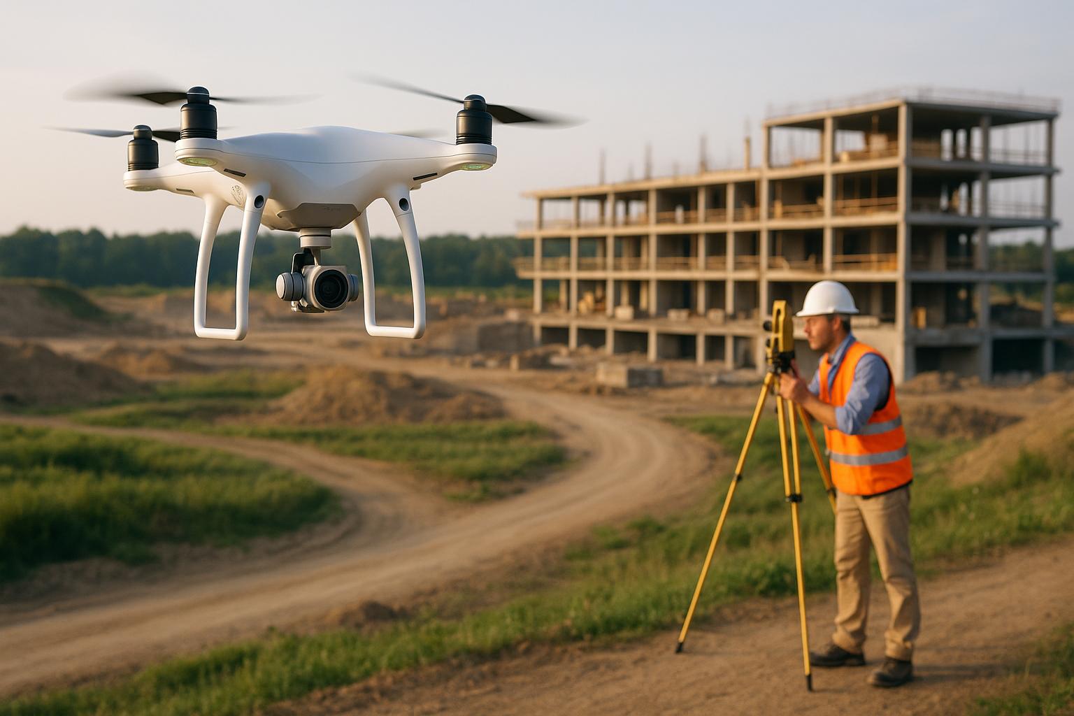
Drone technology is reshaping surveying, offering faster data collection and lower costs compared to traditional methods. While drones excel in covering large areas quickly and reducing labor expenses, traditional methods remain unmatched for precision and legal reliability. Here’s a quick breakdown:
- Drone Surveys: Cost-effective for large-scale projects, with centimeter-level accuracy using RTK GPS. Ideal for construction, agriculture, and inspections. Initial investments include drones, sensors, and software.
- Traditional Surveying: Delivers millimeter-level accuracy, crucial for legal property boundaries and complex designs. Higher labor costs and time requirements make it better suited for smaller, detailed projects.
Key takeaway: Drones save time and money for broad, recurring tasks, while traditional methods are better for precise, legal-critical work. Many companies in 2025 combine both for optimal results.
Traditional Surveying vs Drone Surveying – Survey Drones Ireland

1. Drone Surveys
Drone surveying has reshaped the way companies handle site assessments and mapping tasks. By using unmanned aerial vehicles equipped with high-resolution cameras, GPS systems, and specialized sensors, this technology captures detailed data from above. Let’s dive into the costs, accuracy, and practical applications of drone surveys.
Cost
Investing in drone surveying involves both upfront costs and ongoing expenses. Initial investments cover the purchase or lease of drone equipment, sensors, GPS/RTK systems, and software for processing the collected data. Companies also need to account for operator training and certification costs.
Operational expenses vary depending on the project. These may include travel costs, rush fees for urgent assignments, special permits for restricted airspace, data processing and storage fees, and additional crew if needed. Despite these costs, the efficiency gains often outweigh the expenses.
For many companies, the return on investment is clear. Drone surveys can reduce costs for infrastructure inspections by 50–70% compared to traditional methods. These savings are largely due to reduced labor needs and much faster data collection [2].
Accuracy
Modern drones, equipped with RTK GPS and ground control points, deliver centimeter-level accuracy, meeting the demands of construction, engineering, and mapping projects [2].
However, accuracy depends on several factors, such as weather conditions, flight planning, GPS signal quality, and the techniques used for post-processing. With RTK GPS systems and ground control points, drone surveys offer the precision needed for projects requiring detailed measurements and reliable mapping data.
Suitability for Use Cases
Drone surveys are ideal for covering large areas quickly, often completing tasks in hours rather than days or weeks [2]. This speed is especially useful for time-sensitive projects or ongoing monitoring efforts.
Drones also excel at surveying hazardous or hard-to-reach locations, significantly reducing both risk and cost [2].
Applications include construction progress tracking, environmental assessments, agricultural surveys, and infrastructure inspections. Their versatility makes them a go-to option for numerous industries.
Technology Updates
The capabilities of drone surveying are constantly advancing. High-resolution sensors, longer battery life, and AI-driven data analysis are making it possible to collect more detailed data and process it faster [1].
Emerging technologies like AI, IoT connectivity, and enhanced payload options are pushing the boundaries even further. Additionally, evolving regulations for Beyond Visual Line-of-Sight operations are opening up new possibilities for drone usage [2].
These advancements are expanding the range of applications and making drone surveys an increasingly attractive solution. With better hardware, smarter software, and more flexible regulations, drones are becoming a cost-effective and precise tool for industries ranging from construction to agriculture.
2. Traditional Surveying
Even with the growing popularity of drone surveys, traditional surveying holds its ground as the go-to method for precision and legal reliability. Using tools like total stations, theodolites, GPS receivers, and levels, skilled surveyors can achieve highly accurate, legally recognized measurements.
Cost
Traditional surveying generally comes with higher costs, largely due to the need for experienced professionals and the extended time required for fieldwork. When it comes to surveying large or complex areas, expenses can climb quickly, especially in challenging terrains or intricate projects.
That said, for smaller projects where legal documentation or extreme accuracy is crucial, the higher upfront cost can be worthwhile. It often pays off by ensuring compliance and reducing potential liabilities.
Accuracy
The hallmark of traditional surveying is its ability to deliver millimeter-level precision. This level of detail is critical for tasks where even the smallest error could lead to significant consequences, such as defining legal property boundaries or executing intricate construction designs.
Ideal Applications
Traditional surveying shines in scenarios that demand unparalleled accuracy and legal validity. It is especially suited for:
- Establishing legal property boundaries and creating court-admissible records
- Guiding construction layouts that require exact positioning for complex structures
- Operating effectively in areas with dense vegetation, poor weather conditions, or limited GPS functionality where drones may struggle
- Conducting detailed topographic surveys or working in confined spaces
Advances in Technology
While the core principles of traditional surveying remain unchanged, advancements in technology have made the process more efficient. Modern total stations now feature robotic capabilities, enhanced GPS accuracy, and integrated data management systems, which help streamline workflows and improve overall efficiency.
This combination of precision, reliability, and adaptability underscores why traditional surveying remains a trusted method, despite the rise of newer technologies.
sbb-itb-51b9a02
Advantages and Disadvantages
Choosing the right surveying method means weighing its pros and cons carefully. While cost and accuracy are important, safety often plays a key role in the decision-making process.
For instance, drone surveys significantly boost safety by keeping personnel out of dangerous areas, minimizing the risk of injuries. On the other hand, traditional surveying methods often require workers to navigate unsafe terrains, which can expose them to potential hazards.
Conclusion
Deciding between drone surveys and traditional surveying methods ultimately comes down to your project’s specific needs, budget, and accuracy requirements.
Drone surveys shine in situations where quick data collection over large areas is essential, along with modern safety measures and cost-effective solutions for projects requiring frequent updates. They’re especially useful for startups and growing companies tackling construction, agricultural monitoring, or infrastructure inspections. As technology continues to evolve in 2025, drones are becoming an increasingly practical choice for these industries.
For startups working with tighter budgets, drones can provide a more economical option, particularly for projects that involve vast areas or require regular monitoring. While the upfront cost of professional-grade drones might seem steep, many organizations find the long-term savings in time and labor well worth the investment.
Growing companies could see the most benefit from a hybrid approach. For example, drones can handle initial site assessments and large-scale mapping, while traditional methods can step in for detailed boundary work or final construction layouts. This blend of techniques offers a balance of efficiency and the precision needed for critical measurements, aligning with earlier discussions on cost and accuracy.
Ultimately, the key is matching the surveying method to your project’s goals. Drones offer speed and wide coverage, while traditional methods provide the legal precision and detail necessary for specific tasks. Many businesses in 2025 are finding that combining both approaches leads to the best outcomes.
FAQs
What should I consider when choosing between drone surveys and traditional surveying methods?
When choosing between drone surveys and traditional surveying methods, it’s essential to weigh factors like cost, efficiency, safety, and accuracy. Drone surveys often come out ahead in terms of affordability, thanks to their lower labor demands, faster data collection, and reduced equipment costs. They’re particularly useful for covering large areas or projects that need frequent updates, as they save time and limit workers’ exposure to risky environments.
On the other hand, traditional surveying might be the better option for tasks requiring extremely precise measurements or in situations where drones face obstacles, such as restricted airspace or rough terrain. Carefully evaluate your project’s unique needs to decide which approach works best for your objectives.
How have advancements in drone technology improved their accuracy and legal reliability for surveying?
Recent progress in drone technology – like AI-powered analysis and real-time data processing – has transformed how surveying tasks are carried out. These advancements not only minimize human error but also deliver highly precise measurements, making drones an excellent tool for detailed assessments of land and infrastructure.
On top of that, new regulations introduced in 2025 have simplified the legal framework for drone usage, ensuring they meet safety and operational standards. Together, these technological improvements and regulatory updates make drones a dependable option for accurate and compliant surveying work.
Is combining drone surveys with traditional methods the best approach for companies in 2025, and how can it be effectively applied?
Combining drone surveys with traditional methods offers companies a smart way to achieve top-notch results in 2025. Drones excel at covering large areas quickly and affordably, capturing high-resolution data, and navigating tough terrains with ease. Meanwhile, traditional methods shine when it comes to precise measurements in key areas or verifying the data collected by drones for enhanced reliability.
To make the most of this hybrid approach, start with drones for broad mapping and data collection. Then, use traditional surveying techniques to focus on areas that need detailed analysis or verification. This combination strikes a balance between efficiency, cost-effectiveness, and accuracy, giving businesses a practical way to refine their surveying processes.


Leave a Reply